VIP member
KP400K portable personal positioning terminal
With the gradual popularization of geographic information applications, GPS/Beidou positioning applications are becoming more and more widespread, and
Product details
1. Main purpose
With the gradual popularization of geographic information applications, GPS/Beidou positioning applications are becoming increasingly widespread, and various industries require real-time positioning of employees or related personnel to achieve refined management and supervision. Our company has recently developed a chest card type positioning device, which can be applied to personnel management and attendance supervision in various industries, as well as real-time positioning for school students.
2. Main functions of the system
(1) Real time positioning of personnel positions and recording of trajectories, quantifying their work status for management, and improving their work efficiency.
(2) Real time scheduling can be carried out based on the current on duty situation to scientifically manage personnel.
(3) Locate the relevant personnel and provide scientific decision-making for rescue in emergency situations.
3. Main Architecture of the System
This system consists of three parts: a chest card shaped GPS/Beidou positioning terminal, a wireless transmission system, and an intelligent positioning server. The functions of each part are as follows:
1) Chest card type GPS/Beidou positioning terminal: High sensitivity GPS/Beidou module and GPRS module are built into the chest card, and GPS/Beidou data is transmitted to the intelligent positioning server through the operator's GPRS channel.
2) Transmission system: Using operational GPRS/CDMA channels to transmit positioning data at a low cost.
Intelligent positioning server: Data forwarding function can be achieved through the server, and management personnel can schedule and locate on-site personnel on the central operating computer. The system has comprehensive equipment and user management functions, and is combined with an electronic map system (GIS system) to display real-time positioning information and current status of all users, and save the information to the database for future queries.
Introduction to 4 main positioning devices
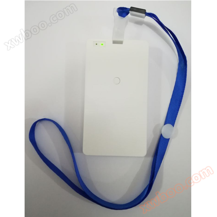
4.1 Equipment Structure
The chest card type positioning system consists of a GPS/Beidou motherboard and a large capacity battery. This product is mainly used for personnel location positioning and patrol management, widely used in enterprise scheduling and management of employees, and can also be applied to student positioning, etc.
The back of the device can be inserted with a standard size badge, and the appearance is as follows: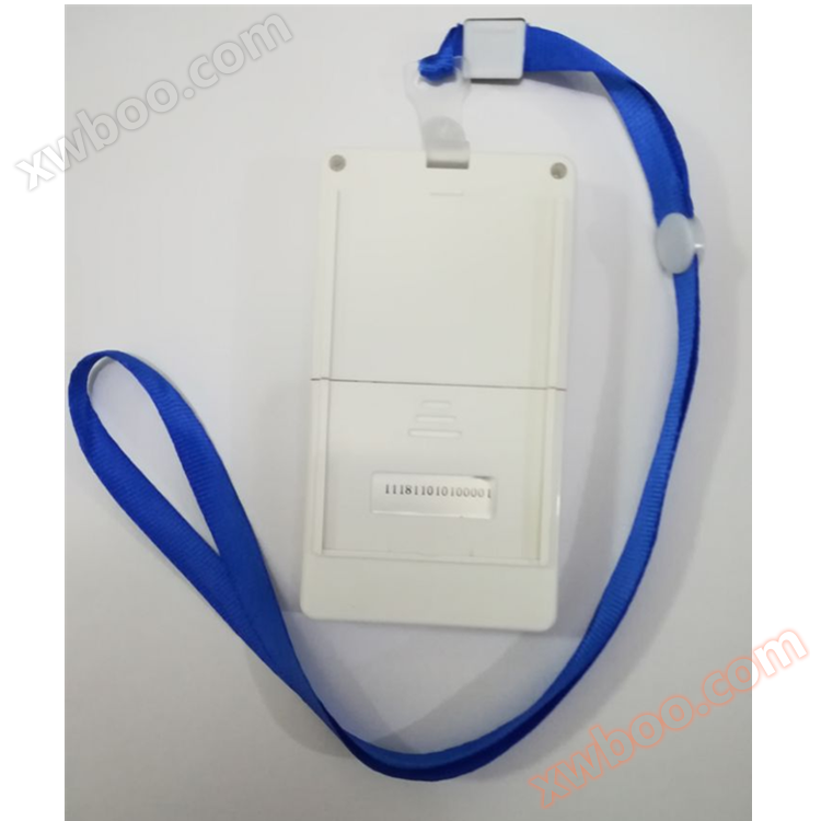

4.2 Main Technical Parameters
GPS/Beidou start time: 40 seconds for cold start, 3 seconds for hot start
Positioning accuracy: 3-5 meters
Speed accuracy: 0.3 meters per second
Data channel: GPRS/CDMA/3G/4G
Power supply method: Comes with a built-in battery
Environmental temperature: -20 ℃ -70 ℃
4.3 Precautions
Indoor or tunnel areasGPS/The Beidou signal is weak and may not be able to locate.
Do not place it in high temperature or strong electromagnetic field environments.
Do not soak this product in water.
If this product is not used for a long time, it should be placed in a cool, ventilated, and dry place.
The battery can work for about 15 hours with a positioning point reported every 15 seconds. Please charge or replace it in a timely manner.
Main functions of the 5 software platforms
5.1 Personnel Management
It can display the positions and personal information of each personnel by group, achieving synchronous display of personnel information and location.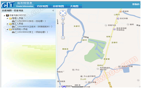
5.2 Real time location
Display the current location and status on the map with icons, and leaders can timely understand the personnel allocation situation on the work computer, while also counting the number of employees in the map.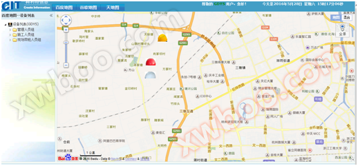
5.3 Trajectory playback
Query historical trajectories according to the set time to achieve quantitative management of personnel. The software automatically calculates personnel's exercise time, stay time, and generates a report.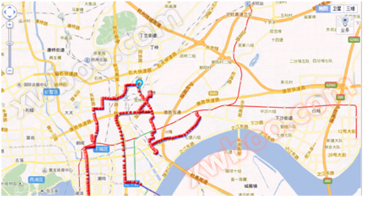
Sports and dwell time statistics

5.4 Regional Settings
A work area can be set on the map, and if personnel exceed the work area, the system will automatically sound an alarm.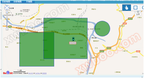
5.5 Satellite Map
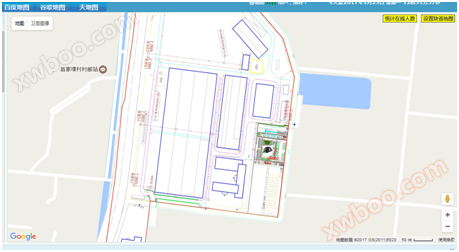
The software supports terrain and satellite maps from Baidu, Google, and Amap, with fast map updates. The software also supports texture mapping, allowing for the pasting of unit floor plans onto the map.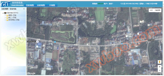
Diagram of texture mapping method
6 Main functions and features
1. Scheduled or query reportingGPS/Beidou position.
2. Support blind spot reporting.
3. Can work continuously at a frequency of reporting every half minute36If you need longer working hours, please contact the manufacturer for customization.
4. supportSOSAlarm function and low battery indicator.
5. The back can be inserted with a regular paper work badge or access control consumption card.
6. Support functions such as static buffering, blind spot reporting, and motion reporting.
7. It has waterproof, dustproof, salt spray resistant and other functions, suitable for humid and rainy environments.
8. The customized version has a timed power on/off function, allowing users to set working hours. The device will automatically turn on during working hours and automatically sleep after work.
9. The customized version has functions such as long-term static alarm and intense motion alarm.
10. The customized version has Bluetooth positioning function
Online inquiry
-
Contacts
-
Company
-
Telephone
-
Email
-
WeChat
-
Verification Code
-
Message Content
-